
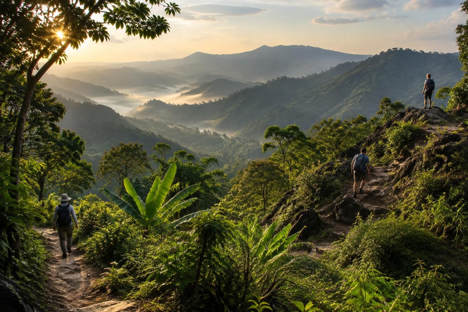
At the edge of Chiang Mai, a forest path climbs from the city toward a temple shaded by trees. Farther south, a high-altitude boardwalk crosses mossy cloud forest; north of the city, limestone mountains demand more preparation and a willingness to accept simple facilities. The best hikes near Chiang Mai are not all summit challenges: some are gentle waterfall walks, while others involve steep ground, local guides or overnight stays.
The right choice depends as much on the day’s weather and transport as on fitness. A short woodland outing can suit a traveler with only a morning free, while a mountain trip deserves an early start and room in the schedule for changing conditions. Temple customs, seasonal closures and air quality also shape the experience. With a little planning, Chiang Mai hiking can make space for both an easy first walk and a more ambitious journey into the hills.
At a glance
- Best first forest hike: the Monk’s Trail to Wat Pha Lat, close to the city.
- Best highland scenery: Kew Mae Pan in Doi Inthanon National Park, when the trail is open.
- Gentler alternatives: Mae Sa Waterfall, Huay Tung Tao Lake and the short Ang Ka boardwalk.
- Best conditions: generally November to February, though mountain weather and air quality still need checking.
- For remote routes: arrange a qualified local guide and confirm park access before paying for a trek.
Monk’s Trail: A First Chiang Mai Hike From Forest to Temple
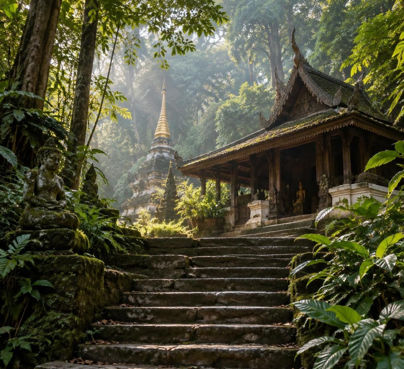
The Monk’s Trail is a practical starting point for anyone curious about Doi Suthep hiking but unsure how their legs will respond to a tropical climb. Its lower section leads from the western side of the city toward Wat Pha Lat, a forest temple where stone figures, streams and old structures sit among the trees.
The trailhead is near Chiang Mai University, above the Suthep Road area. Ask a driver for the Monk’s Trail trailhead rather than simply Wat Pha Lat: the temple can also be reached by road, and the two drop-off points offer very different mornings.
Walking to Wat Pha Lat on the Monk’s Trail
Allow roughly 45 minutes to an hour uphill at a comfortable pace, plus time to look around and descend. Published distances vary with the precise starting point and whether the return is included, so a figure of around two to three kilometers is best treated as an estimate rather than a navigation target.
Tree roots, loose soil and a steady incline make this a real hike, even though many reasonably fit beginners manage it. Orange cloth tied around some trees helps identify the traditional route, but it should not replace attention to junctions or an offline map.
Consider May, a fictional traveler with one free morning and little recent hiking experience. Starting early, carrying water and stopping at Wat Pha Lat gives her a rewarding outing without committing to the steeper climb above; she can turn back whenever the path feels uncomfortable.
At the temple, the pace naturally slows. Clothing that covers shoulders and knees is a respectful choice, and shoes should come off before entering covered shrine areas; ask permission before photographing people, particularly monks.
Continuing the Chiang Mai Trail to Doi Suthep
From Wat Pha Lat, experienced walkers can continue toward Wat Phra That Doi Suthep. The extension is substantially steeper and involves a road crossing, so it is better understood as a separate decision than as an automatic second half of an easy walk.
Check the route carefully at the crossing and avoid following an unmarked track simply because it appears to climb in the right direction. A return by road transport can be a sensible option if the ascent has taken more energy than expected, although a pickup and fare should be agreed before relying on one.
The upper temple is an important Buddhist site as well as a viewpoint. Visitors entering the main temple area should check the current admission charge and follow posted dress requirements; the forest walk itself should not be assumed to include every attraction’s entry fee.
After rain, slick roots and worn patches can make the descent harder than the climb. Shoes with grip and enough daylight matter more than speed, particularly for travelers who have just arrived after a long journey.
The useful choice on this route is the turnaround point: Wat Pha Lat is a destination in its own right, while the upper climb suits a stronger day. Travelers seeking flatter ground can find it around a lake or beside the region’s waterfalls.
Easy Hikes Near Chiang Mai: Waterfalls, Lake Paths and Short Walks
Not every good day outside Chiang Mai involves a steep ascent. For families, travelers returning to exercise or anyone who simply prefers a gentler pace, easy hikes near Chiang Mai include waterfall paths, a reservoir circuit and a remarkably short mountain boardwalk.
Easy does not always mean step-free. Tropical paths can have uneven surfaces, stairs and slippery edges, so it is worth choosing the outing for the least confident member of the group rather than for the strongest walker.
Mae Sa Waterfall and Huay Tung Tao Lake
Mae Sa Waterfall, in the Mae Rim area, has several cascades linked by paths and steps. Visitors can explore for an hour or more, stopping at the lower tiers if the climb becomes tiring instead of treating every level as a requirement.
This flexibility makes Mae Sa one of the more approachable waterfall hikes for a mixed-age group. The falls are especially lively after rain, but that is also when stone and soil can be most slippery; avoid wet rock edges and follow any local restrictions on entering the water.
Huay Tung Tao offers a different kind of outing. The route around the reservoir is roughly six kilometers, mostly on relatively flat ground, and commonly takes around one and a half to two hours at an unhurried walking pace.
Parts of the circuit share space with vehicles and cyclists, and exposed stretches can feel hot. Start early, carry water and use the lakeside food huts as a welcome break rather than assuming there will be shade around the entire loop.
There is an admission charge at the reservoir, and rates should be checked at the entrance. A walker who wants less distance can enjoy a shorter out-and-back stretch; there is no need to complete the circuit to appreciate the mountain backdrop.
Ang Ka and Pha Chor: Short Chiang Mai Nature Walks
At the summit area of Doi Inthanon, the Ang Ka Nature Trail is a boardwalk loop of roughly 360 meters through damp, moss-covered highland forest. It is short enough for visitors who do not want a long hike, although the drive from Chiang Mai makes it part of a full-day excursion.
The boardwalk protects fragile ground, so staying on it matters. Cool air and mist can make the forest feel very different from the city, and a light layer is useful even when the lowlands are warm.
For a contrasting landscape, Pha Chor in Mae Wang National Park has eroded rock formations and a relatively short walking route. Stairs and exposed sections still require care, and visitors should check the park’s current access and entry arrangements before traveling.
These choices show why hiking for all skill levels is possible in the region: the reward might be a cascading stream, a quiet meal by the water or an unusual forest, not necessarily a summit. For a longer highland walk, Doi Inthanon also has a more demanding loop.
Doi Inthanon Hiking: Kew Mae Pan and Highland Forest Views
Doi Inthanon National Park protects the slopes of Thailand’s highest mountain, whose summit reaches approximately 2,565 meters. The journey from Chiang Mai commonly takes around one and a half to two hours each way, depending on the destination within the park and road conditions.
That travel time makes Doi Inthanon hiking a full-day commitment rather than a quick city escape. The reward is a change in landscape: cooler forest, highland vegetation and views across overlapping ridges when the weather is clear.
Kew Mae Pan: One of the Best Moderate Hiking Trails
Kew Mae Pan is a loop of roughly three kilometers, with estimates varying slightly by source. Allow around two to three hours for the walk, stops and interpretation rather than measuring the outing only by distance.
The route moves through cloud forest and onto more open highland slopes. Roots, steps and changes in elevation make it more demanding than its modest length suggests, but hikers with reasonable mobility and patience can enjoy it without needing expedition-level fitness.
A local guide is required for Kew Mae Pan and is arranged at the trail entrance. The guide helps visitors follow park rules and can explain the plants, terrain and communities connected to the area; ask about language arrangements when organizing transport.
The trail closes seasonally, commonly during the rainy months, and the exact reopening date can change. Confirm its status directly with the park before booking a vehicle, especially near the beginning or end of the usual hiking season.
Clouds do not appear on command, and a famous viewpoint can be misted over. That does not make the trip a failure: the forest itself is part of the attraction, and a flexible schedule leaves room to enjoy it without rushing toward a photograph.
Planning a Doi Inthanon Day Trip
May and her fictional friend Arun could combine Kew Mae Pan with Ang Ka for two very different perspectives on the mountain. If the longer loop is closed or one of them feels tired, the short summit-area boardwalk can still offer a worthwhile stop, subject to park conditions.
The nearby Royal Pagodas are another possible visit, with gardens and viewpoints when visibility allows. Check opening arrangements and any separate charge, and leave enough time for the return journey rather than filling every hour with stops.
Earlier published estimates put foreign adult park admission at around 300 THB and the Kew Mae Pan guide at around 200 THB per group. These are planning references, not confirmed 2026 prices: verify current charges, group limits, vehicle fees and any additional attraction fees with the park before departure.
Bring a layer against wind or mist, shoes that grip damp ground and enough water for the walk. A private driver or organized trip removes the pressure of navigating mountain roads, but travelers should agree on stops, waiting time and what is included before setting off.
Altitude and access shape the day more than distance alone: a short highland trail can require an early start, a guide and a full transport plan. For travelers seeking still more independence or remoteness, the surrounding mountains offer tougher choices.
Challenging Hikes Near Chiang Mai: Doi Pui, Mae Wang and Chiang Dao
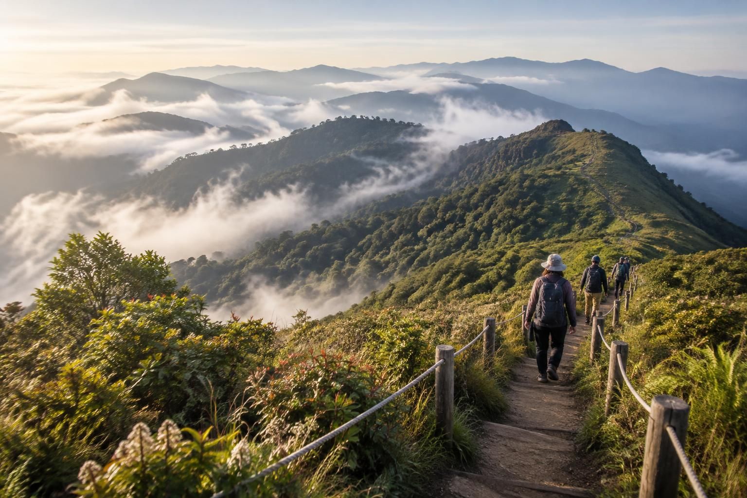
For a stronger day in the hills, the route matters more than the mountain’s name. Doi Pui has several approaches, Mae Wang operators use different itineraries, and access around Chiang Dao depends on protected-area rules; each requires more specific planning than simply arriving with a destination in mind.
These challenging hikes can involve steep ground, uncertain weather or long travel, even when the stated distance appears modest. A local guide is particularly valuable where paths are faint, river crossings are involved or communities manage access to their land.
Doi Pui and Mae Wang Mountain Routes
Doi Pui, the highest peak in Doi Suthep–Pui National Park, offers forest routes that feel quieter than the lower Monk’s Trail. Some summit itineraries are described as roughly five to six kilometers round trip, but distance and difficulty vary considerably with the chosen trailhead.
Do not assume that a short Doi Pui loop and a longer summit approach are the same walk. Ask the park or a knowledgeable local guide which route is currently accessible, how much climbing it involves and whether the summit offers an open view or a wooded stop.
In Mae Wang, guided outings may cross forest, streams and agricultural land, with some trips continuing to village accommodation. A full-day hike can be suitable for moderately fit walkers, while a multi-day itinerary brings the additional demands of carrying belongings and spending longer away from services.
Before booking, ask for an approximate walking distance, elevation gain, group size and a clear description of transport and meals. An itinerary advertised as an adventure may contain more driving than walking, or include activities that a traveler would rather avoid.
If an operator offers an elephant encounter, examine the conditions carefully. Favor observation without riding, forced interaction or performances, and choose a different itinerary if the operator cannot explain its animal-welfare practices.
Chiang Dao Treks and Responsible Village Visits
North of Chiang Mai, the Chiang Dao area is known for limestone peaks and caves. A cave visit is a separate activity from a mountain trek; seeing one does not automatically mean that nearby summit routes are open or available.
Access to Doi Luang Chiang Dao is tightly regulated, with seasonal openings, permits, quotas and guide or porter requirements subject to official rules. Arrange any summit attempt through the responsible protected-area authorities and an approved operator, and do not plan around an assumed opening date.
Multi-day routes elsewhere in the northern highlands also require a detailed conversation about accommodation and local access. A village homestay should be arranged with hosts who agree to receive visitors, not treated as an attraction that can be entered without invitation.
Arun might choose a guided Mae Wang day instead of a remote overnight trip if he wants forest walking without carrying camping equipment. That is not a lesser adventure: matching the itinerary to the group’s time, experience and comfort helps everyone enjoy the landscape responsibly.
Ask before photographing residents, keep voices low around homes and pay fairly for guiding, food and accommodation. Good preparation protects both the visitor and the places being visited; it also makes the practical details of season, transport and budgeting worth considering next.
Planning Chiang Mai Trails: Seasons, Transport, Costs and Safety
A successful walk starts before the trailhead. Among the many Chiang Mai trails, the most enjoyable choice on a given day depends on air quality, recent rainfall, available transport and the group’s energy—not just the photograph that inspired the trip.
When to Hike and What to Carry Near Chiang Mai
November to February is generally the most comfortable period, with cooler, drier conditions and popular trails at their busiest. Temperatures vary with elevation and time of day, so a mountain morning can feel markedly colder than an afternoon in the city.
March to May often brings intense heat and smoke from regional burning. Check current air-quality readings before setting out, particularly for children, older travelers and anyone with respiratory concerns; postpone strenuous exercise when pollution is high.
From June to October, rain turns the landscape green but can make paths muddy, obscure river crossings and trigger temporary closures. Leeches are possible in damp forest, and waterfalls can become dangerous after heavy rain, even when the sky has cleared.
For a half-day outing, pack water, a charged phone, an offline map, insect repellent and footwear with reliable grip. Around two liters of water can be a useful starting point for a longer warm-weather walk, but the amount needed depends on heat, effort and access to safe refills.
Carry a light rain layer, sun protection and personal medication; add warm clothing for higher elevations. Tell someone where the group is going and when it expects to return, and turn back if weather, fatigue or a confusing junction makes the route unsafe.
Transport and Trail Costs Around Chiang Mai
Red songthaews can be inexpensive on shared city routes, but a direct trip to a trailhead is often negotiated as a private fare. Agree on the destination and price first; a ride-hailing car can also work well, though mobile coverage and return availability may be limited outside town.
Renting a scooter offers flexibility only to riders with the correct motorcycle entitlement, an accepted international driving permit where required, appropriate insurance and the experience to handle mountain roads. A helmet and careful riding matter more than saving a small transport fare.
The table uses earlier published estimates as budgeting references, not guaranteed 2026 prices. Confirm current charges with the park, driver or operator, and check whether a quoted guide fee is per person or per group.
| Expense | Earlier estimate | What to check |
|---|---|---|
| Monk’s Trail to Wat Pha Lat | Generally free to walk | Separate charges may apply at other attractions. |
| Doi Inthanon foreign adult entry | Around 300 THB | Current admission, vehicle fees and eligibility. |
| Kew Mae Pan local guide | Around 200 THB per group | Current rate, group size and trail opening. |
| Mae Wang guided day trek | Roughly 800–1,500 THB | Walking time, transport, meals and group size. |
| Private full-day guide | 2,000 THB or more | Whether transport and park fees are included. |
For travelers with three days, a balanced plan might pair Wat Pha Lat with a relaxed first morning, reserve another day for a lake or waterfall walk, and leave the final day for Doi Inthanon. Keeping those days interchangeable allows the group to respond to rain, smoke or a temporary closure.
On any route, stay on permitted paths, carry rubbish out and avoid feeding wildlife. The best itinerary leaves enough flexibility to stop early, change plans and still enjoy the day.