
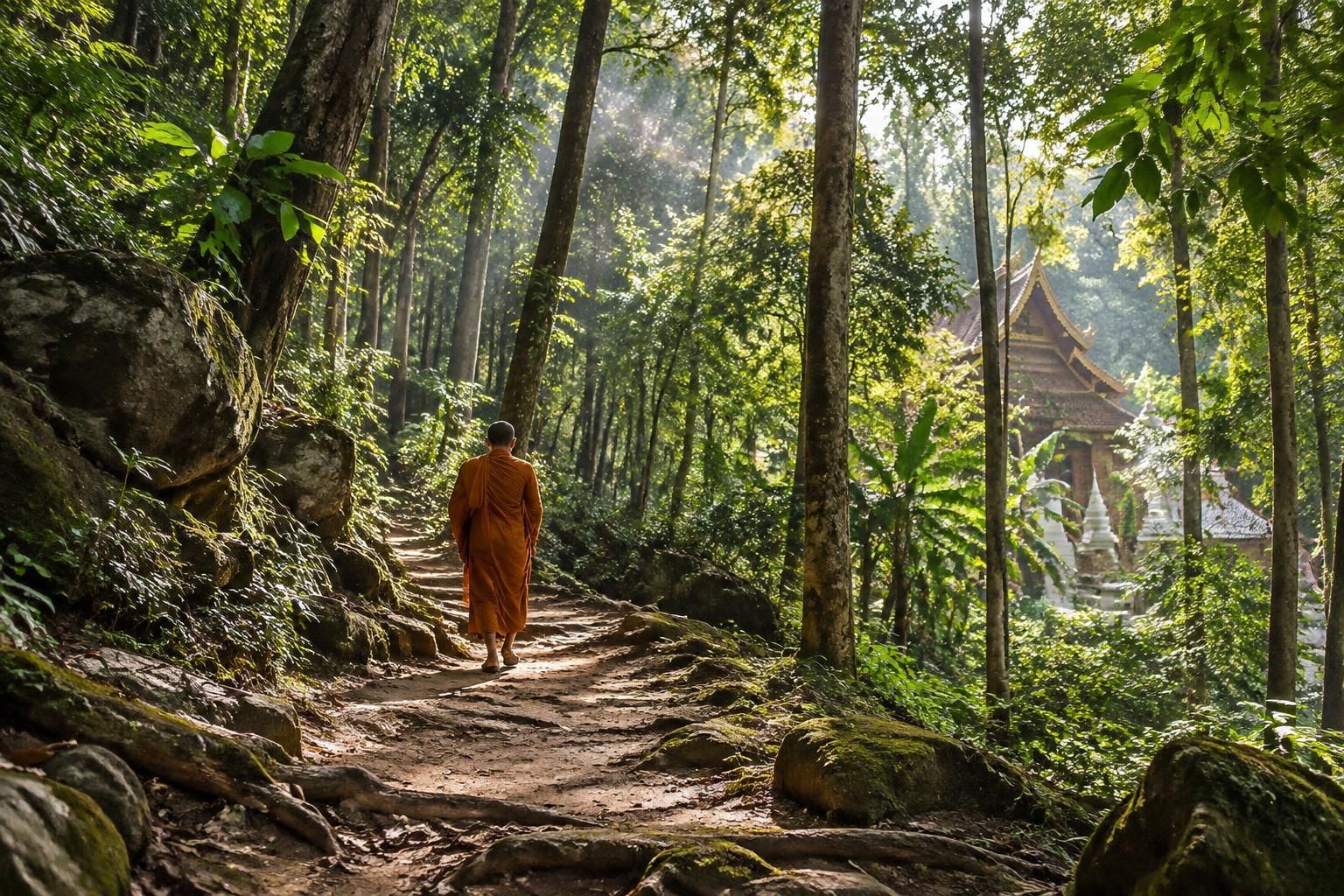
Above the streets of Chiang Mai, a narrow path climbs into the wooded foothills of Doi Suthep. Its destination is Wat Pha Lat, a working Buddhist temple where carved figures, old stonework and a seasonal stream sit among the trees. The route is commonly called the Monk’s Trail, and its appeal lies as much in the gradual change of pace as in the temple itself.
The walk is short enough for many travelers to fit into a morning, but it is not a paved stroll. Roots, loose soil and humidity can make the climb feel more demanding than its distance suggests. Those with more time and energy can continue toward Wat Phra That Doi Suthep, although that second stage is considerably steeper and requires a separate decision about transport, weather and fitness.
For a traveler arriving at a hostel with muddy shoes and a free morning, the practical questions are usually straightforward: where does the path begin, what should go in a daypack, and how should visitors behave at the temple? This guide follows those decisions from the city edge to the mountainside.
At a glance
- Destination: Wat Pha Lat, a forest temple above Chiang Mai University.
- Distance: approximately 1.5 kilometers each way on the commonly used route.
- Walking time: allow roughly 40–60 minutes uphill, plus time at the temple and for the descent.
- Difficulty: a short but uneven climb, with slippery sections after rain.
- Bring: water, grippy shoes, insect repellent and clothing that covers shoulders and knees at the temple.
- Longer option: continue uphill toward Wat Phra That Doi Suthep only with sufficient daylight, water and a reliable route.
Finding the Monk’s Trail Trailhead from Chiang Mai
The usual starting point lies behind Chiang Mai University, on the lower slopes of Doi Suthep and south of the zoo. It is close to the city by mountain-hiking standards, but it is not inside the Old City and should not be confused with the entrance to Chiang Mai Zoo or the main road up to Doi Suthep.
For a first visit, search a current map for “Monk’s Trail trailhead” and check that the pin is near the university’s western edge. The final approach follows local roads toward the foothills, so an offline map or screenshot is useful if mobile data becomes unreliable.
Getting to the Monk’s Trail by taxi or scooter
A taxi, ride-hailing car or tuk-tuk can take visitors close to the trailhead. From central Chiang Mai, the drive is often around 20 minutes, although traffic, pickup location and the route chosen can change that considerably.
Show the driver the map pin rather than asking only for “Doi Suthep.” That name can refer to the mountain, the national park or the famous upper temple, which are not interchangeable destinations.
Travelers comfortable riding a scooter may prefer the flexibility of their own transport, particularly if they plan to return to the same starting point. A valid license, helmet and insurance that covers the activity matter more than saving a few minutes, and an unfamiliar rider should not treat this short journey as a reason to learn on Chiang Mai’s roads.
Parking arrangements can change, so leave a vehicle only where permitted and avoid blocking gates, homes or access roads. Secure belongings out of sight; a daypack containing water and temple clothing belongs on the hike, not under an exposed seat.
Planning the return before entering the forest path
The simplest outing is an out-and-back walk: climb to Wat Pha Lat, explore respectfully, then descend to the original trailhead. This keeps the transport plan straightforward and avoids the need to arrange a pickup on the mountain road.
Alternatively, the temple has road access, so visitors who decide not to walk down can look for a ride from the road. Availability and fares vary, however, and a car cannot be assumed to be waiting at the temple entrance; agree on a pickup point and price before relying on this option.
Consider a fictional traveler, Maya, who has a train to catch later in the day. She books a car to the university-side trailhead, saves the location on her phone and leaves enough time to retrace her steps without rushing through the temple.
Someone combining the hike with other Chiang Mai plans can also browse these Thailand travel ideas while arranging the rest of the day. The important detail is to keep the hike’s timing separate from any fixed transport booking.
Look for the established entrance and follow the main path rather than cutting through university grounds or private property. A little care at the city end makes the transition into the forest feel much less complicated.
Hiking the Monk’s Trail to Wat Pha Lat
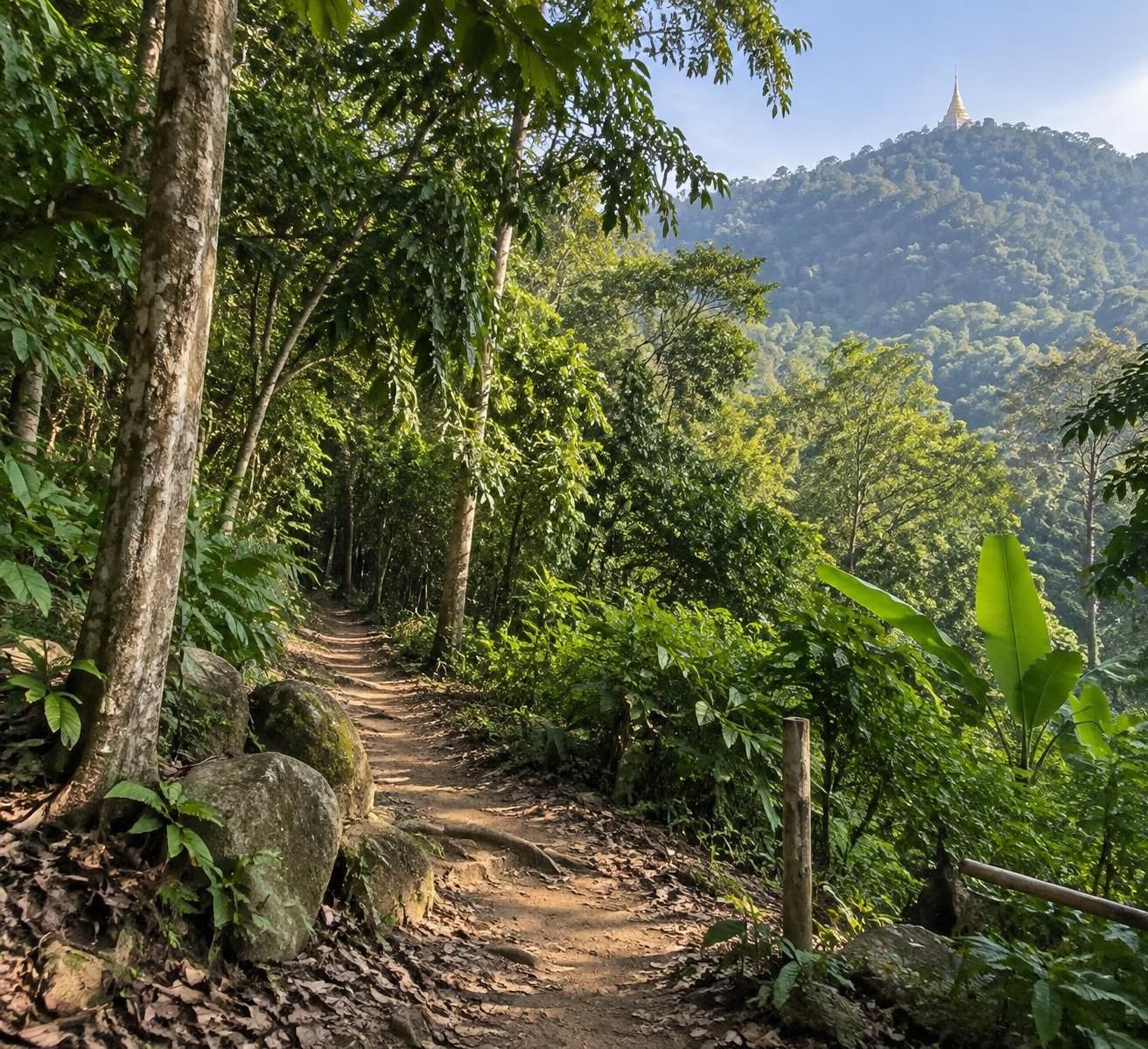
The most familiar section of the temple trail climbs approximately 1.5 kilometers from the university-side entrance to Wat Pha Lat. Estimates vary with the exact starting point, but an elevation gain of roughly 187 meters gives a useful sense of why a short distance can still leave walkers warm and breathless.
Many people reach the temple in 40–60 minutes. That estimate is not a deadline: a relaxed pace, photographs, muddy ground or a need for frequent breaks can make the journey longer, especially for travelers unaccustomed to Chiang Mai’s humidity.
What the Chiang Mai forest path feels like
Underfoot, expect earth, exposed roots, stones and patches of uneven ground rather than a maintained city walkway. The canopy provides shade, but the air can feel still and damp, and the climb is noticeable even when the gradient does not look dramatic on a map.
Orange or saffron-colored cloth tied around some trees is commonly associated with the route. Treat these strips as helpful visual cues rather than a complete navigation system: paths can branch, markers can fade, and a turn that looks obvious on the ascent may be less clear on the way back.
A downloaded map, a charged phone and attention to the main track are sensible companions. If a junction becomes confusing, stop while there is still plenty of daylight, check the route and turn back rather than pushing into unfamiliar vegetation.
The scenery changes with the season. In wetter months the foliage is especially lush and small waterways may be more audible, while drier periods can leave the ground dusty and reduce the flow of streams near the temple.
Birdcalls and insects add to the experience, but wildlife is best observed from a distance. There is no reason to expect elephant sightings on this short hike, and feeding animals or approaching them for a photograph can disturb both wildlife and other visitors.
Choosing a pace that makes the climb enjoyable
Imagine Maya starting briskly because the distance looks modest, then noticing her breathing change after the first uphill stretch. A brief pause on stable ground, a drink and a slower rhythm turn the climb into a manageable morning rather than a test of speed.
Walkers with knee or balance concerns should pay particular attention to the descent. Going downhill can take as long as going up because loose earth and wet roots demand careful foot placement; there is no prize for reaching the bottom first.
Families and mixed-ability groups can make the outing work by agreeing in advance that anyone may request a break or turn around. Young children should remain close to an adult, particularly where the path narrows or the slope falls away.
A local guide is optional on the standard route, not a requirement. For visitors who prefer company or want context about the landscape and religious sites, a knowledgeable guide can add value; confirm the route, meeting point and price before booking.
As the trees begin to open around the temple grounds, the character of the outing changes. The next part is less about covering distance and more about entering a place where worship, everyday monastic life and sightseeing meet.
Visiting Wat Pha Lat on the Monk’s Trail
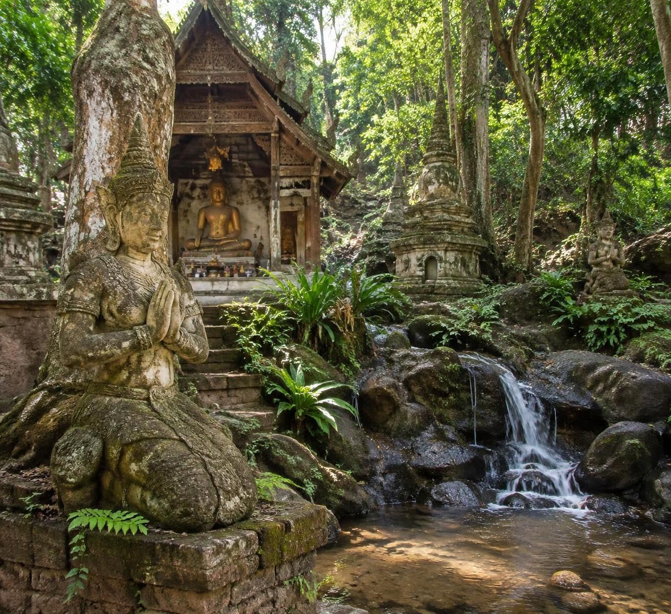
Wat Pha Lat sits on a wooded slope, with buildings and shrines spread among trees, rocks and watercourses. Its setting feels different from a compact city temple: visitors arrive gradually, encountering stone figures, carved details and glimpses of Chiang Mai through the foliage.
The temple is a living religious place, not simply a scenic stop created for hikers. People may be praying, working or resting on the grounds, and their activities deserve the same consideration visitors would offer inside any place of worship.
Exploring Wat Pha Lat’s shrines and stream
Allow time to notice the small details rather than heading straight for a photograph. Weathered carvings, Buddha images and decorative naga figures contribute to the atmosphere, while moss and tree roots show how closely the structures sit within the surrounding woodland.
A stream runs through the area, and its flow changes with rainfall. During wet weather, water and greenery can make the grounds feel especially fresh, but slick stones and steep edges call for caution; the stream is not an invitation to scramble across every available rock.
Views toward the city are possible from parts of the grounds when visibility is clear. Smoke, haze, clouds and foliage can soften or obscure the panorama, so it is worth appreciating the temple’s craftsmanship and forest setting as well as looking for mountain views.
A visitor like Maya might arrive expecting a single landmark and instead spend half an hour moving quietly between separate features. That slower visit also gives her time to cool down before deciding whether the return walk or the longer ascent suits her energy.
Temple etiquette for hikers in Chiang Mai
Before approaching prayer areas, cover shoulders and knees. Lightweight long trousers and a shirt with sleeves work well, while a wrap or overshirt in the daypack can help hikers who prefer cooler clothing on the ascent.
Remove shoes where signs or local practice indicate, particularly before entering an enclosed worship space. Keep voices low, silence phone audio and avoid posing on religious objects, climbing statues or treating the grounds as a backdrop for disruptive photo sessions.
Give monks and worshippers space, and ask permission before taking a close-up photograph of a person. Monks may use the route, but an encounter is not guaranteed, and visitors should never interrupt an alms round or religious activity to create one.
A donation can support the temple if an appropriate donation box is available, but it should be understood as voluntary rather than a substitute for respectful behavior. Bring some small change if making an offering matters to the visit, and do not assume that a shop or card payment will be available.
The route is often described as part of an older network connecting communities and temples on the mountain. The white-elephant story is associated with the founding of Wat Phra That Doi Suthep; it belongs to the mountain’s religious tradition rather than serving as a confirmed account of how this particular footpath was built.
These distinctions make the visit richer: Buddhist temples are places with histories and present-day communities, not just stops on a checklist. From Wat Pha Lat, the upper mountain is an option, but it deserves its own plan.
Continuing from Wat Pha Lat to Wat Phra That Doi Suthep
Wat Pha Lat is a worthwhile destination in its own right; reaching it does not create an obligation to climb farther. The continuation toward Wat Phra That Doi Suthep is a different proposition, with a steeper trail, more exposed sections and a greater demand on time and energy.
The route involves reaching and crossing the mountain road before finding the continuation uphill. Traffic can move quickly around bends, so choose a clear crossing point, watch carefully in both directions and avoid standing in the roadway while checking a map.
Deciding whether to take the upper Doi Suthep hike
Before leaving the lower temple, check three things: remaining daylight, the weather and the group’s condition. A traveler who is already overheated or low on water will not improve the day by committing to a harder ascent simply because it appears nearby on a map.
Trail conditions and navigation can be more challenging above Wat Pha Lat, particularly after rain. Use a current route, tell someone the plan and consider going with an experienced companion or local guide if unfamiliar with steep forest terrain.
Plan the return independently from the ascent. Walking back down the same way is possible for well-prepared hikers, but it adds substantial effort; another option is to seek a red songthaew or other transport from the upper temple area, with the fare and destination agreed before departure.
Transport is not necessarily immediate or private. Maya, for example, might find the upper climb appealing but choose to descend from Wat Pha Lat because she has limited water and an afternoon commitment. That is a practical decision, not a lesser version of the experience.
For broader trip planning, these Thailand travel resources can sit alongside a current local map and accommodation advice. The latter are particularly useful for recent weather and transport conditions.
What to expect at Wat Phra That Doi Suthep
The upper temple is one of northern Thailand’s most important Buddhist sites. Its celebrated golden chedi is associated with a Buddha relic, and the surrounding courtyard contains shrines, images and detailed religious decoration.
From the road-level entrance, visitors commonly climb a long staircase bordered by naga sculptures. A lift may be available for visitors who need an alternative, but operating arrangements and any charges should be checked locally.
The temple’s viewpoints can offer sweeping scenes across Chiang Mai when the air is clear. Visitors should enjoy views from designated areas rather than attempting to climb the chedi or other sacred structures.
Dress respectfully here as at Wat Pha Lat, and check posted admission rules and current fees on arrival. Foreign visitor charges or access arrangements can change, so carrying cash and allowing a little extra time is sensible.
The contrast between the wooded lower temple and the prominent golden shrine makes the longer outing memorable. It also makes preparation more important: the farther the route goes, the less useful a casual city-walk mindset becomes.
When to Hike the Monk’s Trail and What to Pack
Chiang Mai’s weather shapes this outing as much as the map does. A comfortable morning can turn hot quickly, while recent rain may leave shaded ground slippery long after the clouds have cleared.
An early start usually offers cooler conditions and more time to adjust plans. Start after there is enough natural light to see the path clearly; beginning before sunrise without suitable lighting and route knowledge adds unnecessary difficulty.
Seasonal conditions on the Chiang Mai temple trail
The cooler, drier months are often comfortable for walking, although mornings can still become warm on the climb. During the rainy season, vegetation is lush and streams are more active, but mud, wet roots and sudden downpours require extra care.
In the hotter part of the year, heat builds quickly and water needs increase. Smoke and poor air quality can also affect Chiang Mai seasonally, particularly during periods of agricultural burning; check a current air-quality reading before setting out and postpone strenuous outdoor exercise when conditions are unhealthy.
Rain is not the only reason to reconsider a hike. A forecast of thunderstorms, poor visibility, illness or a park closure can make a café morning and a road-access temple visit the kinder choice for everyone in the group.
| Condition | What to expect | Practical response |
|---|---|---|
| Cool, dry morning | Generally comfortable walking, with uneven ground | Start early and carry water and temple clothing |
| Recent or ongoing rain | Mud, slippery roots and variable stream flow | Wear grippy shoes, slow down and avoid swollen watercourses |
| Hot weather | Greater fatigue and dehydration risk | Walk in the cooler hours, take breaks and bring extra water |
| Smoke or haze | Reduced visibility and potentially unhealthy air | Check current air quality and postpone if conditions are poor |
A practical packing list for the Monk’s Trail
Footwear with reliable grip is more useful than fashionable sandals. Add breathable clothing, sun protection for exposed stretches and insect repellent, especially if mosquitoes tend to bother you.
Carry enough drinking water for the walk and any delay, plus a small snack if continuing beyond Wat Pha Lat. There is no dependable reason to assume food, drinking water or toilets will be available at every point on the route.
A charged phone, offline map, small first-aid kit and a light rain layer fit comfortably in a modest daypack. Pack out tissues, wrappers and other rubbish, and stay on established tracks to limit erosion and disturbance to vegetation.
Solo hikers can enjoy the route without treating solitude as a challenge to prove. Share the intended trail and expected return time with a trusted person or accommodation staff, and keep enough phone battery to arrange help or transport if plans change.
For Maya, the final check is simple: water in the bag, shoulders and knees covered for the temple, and enough time to descend before dark. A well-packed day leaves room to notice the forest instead of worrying about what was forgotten.